
Field Log
A growing archive of documented observations supporting community research throughout Indian River County.
Every Field Log records a real place, a real time and a real observation. Together, these records preserve local conditions, inform research and invite the community to help shape thoughtful solutions.
Field observations document conditions at a particular moment. They do not, by themselves, establish causes, official findings or agency conclusions.
Press play to hear the original field audio, including active sirens.
Emergency Vehicle Movement
- Initiative
- Safe Passage
- Research Area
- Traffic Safety & Emergency Response
- Location
- Route 60 & 27th Avenue, Vero Beach, Florida
- Date
- Thursday, May 21, 2026
- Time
- 12:35 PM EDT
- Observer
- Kenneth P. George, Founder, Pierpoint Institute
- Media
- Ground video with original audio
Ground-level documentation of emergency vehicle movement at Route 60 and 27th Avenue, a corridor used by ambulances traveling toward Cleveland Clinic Indian River Hospital. Preserved to support ongoing study of traffic operations and emergency-response mobility.
Press play to hear the original field audio, including active sirens.
Fire Rescue Response
- Initiative
- Safe Passage
- Research Area
- Traffic Safety & Emergency Response
- Location
- Route 60 & 58th Avenue, Vero Beach, Florida
- Date
- Wednesday, October 26, 2022
- Time
- 3:31 PM EDT
- Observer
- Kenneth P. George, Founder, Pierpoint Institute
- Media
- Ground video with original audio
Ground-level documentation of an Indian River County Fire Rescue vehicle moving through the Route 60 and 58th Avenue intersection. Preserved as part of the long-term Field Log for transportation and emergency-response research.
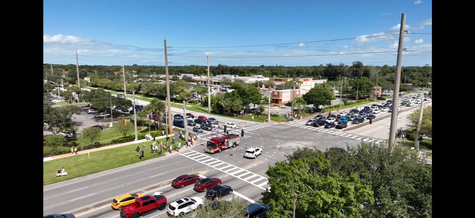
Intersection Operations
- Initiative
- Safe Passage
- Research Area
- Traffic Safety & Emergency Response
- Location
- Route 60 & 58th Avenue, Vero Beach, Florida
- Date
- Saturday, October 18, 2025
- Time
- 1:56 PM EDT
- Observer
- Kenneth P. George, Founder, Pierpoint Institute
- Media
- DJI aerial observation
Aerial documentation of traffic conditions and emergency vehicle movement during a period of elevated roadway activity. The elevated perspective preserves a systems-level view of intersection geometry, queues, pedestrian activity and response movement without assigning cause or drawing an official conclusion.
What have you observed?
Share your experience at local intersections and help identify priorities for future traffic-safety research.